Buscar
-
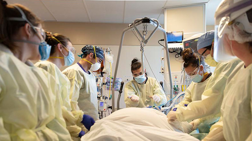
Dos años que no olvidaremos: la COVID-19 en Renown Health
On March 19, 2020, Renown Regional admitted the first patient in need of care while sick with COVID-19. Our providers navigated two years of a pandemic and overcame many challenges while providing the best care for our patients and the community. Anicia Beckwith’s series “The Art of Healing” captured Renown Health during this time. Let's take a look back on the last two years. February 2020: Standing Up the Hospital Incident Command System (HICS) On February 25, 2020, leaders at Renown Health stood up Renown’s Hospital Incident Command System (HICS), a standardized system used to organize response personnel and resources and manage response operations during emergencies and crises. March 2020: Temporary Deployable Medical Structure Placed Outside Renown Regional Emergency Department On March 12, 2020, Renown set up a deployable medical facility to serve as a respiratory illness screening center for emergency room patients at Renown Regional. A similar tent was also set up outside the emergency room at South Meadows Medical Center. This proactive measure helped our teams care for community members with respiratory illness symptoms while protecting patients and staff in the emergency department and other areas of the hospital. Check out photos of the tent here. Read the Reno Gazette Journal Article about the tent here. April 2020: Alternate Care Site at Mill Street Parking Structure at Renown Regional Renown’s HICS team decided to create an Alternate Care Site (ACS) in the Renown Regional Medical Center Mill Street parking structure. The ACS served additional hospitalized patients and allowed caregivers to remain on campus and still have access to existing hospital infrastructure such as lab, pharmacy, imaging, food services and other critical services. After just 10 days of construction, the ACS was completed on April 3, 2020 with space to hold up to 1,400 patients. Check out photos of the ACS under construction here. On Nov. 12, 2020, Renown opened the ACS to serve additional hospitalized patients diagnosed with COVID-19 who were clinically stable or improving. Healthcare workers at Renown cared for hundreds of patients at this site. In early Jan. 2021, the remaining patients returned home. Check out the video of Connie, a patient who received care in the ACS. April and July 2020: The LOVE Sculpture Placed at Renown Regional On April 16, 2020, during a time of darkness and uncertainty, Artown loaned Renown the LOVE sculpture, a one-ton aluminum piece of art created by artist Laura Kimpton and fabricated by Jeff Schomberg. The structure, which originally debuted at Burning Man, was lit up Renown Regional's main entrance on Mill St. Watch a video about the LOVE sculpture’s debut at Renown Regional. On July 13, 2020, thanks to the support of former board chair and community supporter Blake Smith and the Keyser Foundation, the LOVE sculpture is now a permanent fixture at Renown Health. Throughout the pandemic, it has served as a source of inspiration, hope and positivity for our community and care providers. Check out a video of the LOVE is Here to Stay celebration. June 2020: Renown Offers In-House COVID Testing In June 2020, the Renown laboratory team sprang into action to help meet the growing demand for COVID-19 testing amongst Washoe County residents and businesses. Renown invested in expanded staffing and in-house testing capabilities that ensured our teams could swab and process up to 1,000 COVID-19 tests for patients each day. All with results returning within hours. November 2020: Renown Introduces “Hospital At Home” Remote Monitoring In November 2020, six patients at Renown Regional Medical Center and Renown South Meadows Medical Center diagnosed with COVID-19 were outfitted with a remote Hospital at Home monitoring system. Renown clinicians plan to continue using this system to monitor upwards of 1,000 hospitalized patients and lower acuity patients from their homes. December 2020: Renown Administers COVID-19 Vaccines to Health Care Employees On Dec. 17, 2020, Renown began to vaccinate its healthcare workers. Among those receiving the first vaccines was Luis Martinez, a technician on Renown’s Clinical Decision Unit who cared for patients recovering from COVID-19 in the Alternate Care Site field hospital. Read the Reno Gazette Journal article about the COVID-19 vaccine rollout at Renown. January 2021: Renown Administers COVID-19 Vaccines to Community After several weeks of successful employee and volunteer drive-thru vaccination events, Renown supported the Washoe County Health District and the state in vaccinating Washoe County community members. Click here for a playlist of videos featuring Renown Health employees and patients talking about the importance of the COVID-19 vaccine. February 2021: Local Widow Inspires Renown to Change Visitor Supporter Policy Darlene Randolph’s husband Dave spent 17 days hospitalized at Renown Regional Medical Center before losing his battle with COVID-19 on December 13, 2020. Darlene wrote a passionate letter to Renown Health asking for the visitor policy that allowed patients with COVID-19 to receive visitors. In February 2021, Renown hospitals were among the first in the country to lift visitor restrictions for patients with COVID-19 to encourage families to be at the patient's bedside. Read Darlene’s full story here. May 2021: Renown Celebrates Volunteers, Partners and Community Who Aided in Vaccine Efforts In May 2021, Renown administered the last dose of COVID-19 vaccines to community members in Renown’s drive-thru clinic. Between January and May 2021, over 80,000 doses were administered at the drive-thru. View drone footage of this effort here. Click here to see pictures of vaccine volunteers and employees. November 2021: Renown Offers Vaccine for Children Ages 5+ In November 2021, Renown vaccinated children in the Reno-Sparks community with the 2-dose series in a limited round of weekend clinics. The vaccine clinics featured therapy dogs, local mascots and donuts donated by Doughboy’s Donuts. Click here to see pictures of the children’s vaccine clinics and watch a video about the clinics here.
Read More About Two Years We Won't Forget: COVID-19 at Renown Health
-
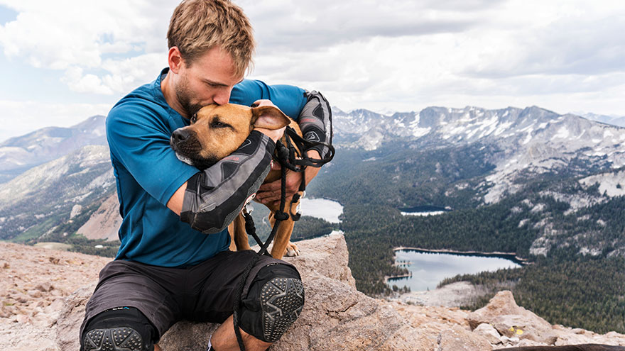
8 Local Hiking Trails You Need to Explore
Need fresh hiking trails? These hiking trails offer new views, a different route or the motivation you need to get outside. Of course, whatever you’re looking for this summer, these trails were made for sunshine in Reno-Tahoe. Easy Hiking Trails Oxbow Nature Study Area Nature Trail Location: 3100 Dickerson Road, at the Truckee River. Parking: There is a parking lot onsite. Time Out and Back: 30 minutes Items to Bring: Water, sunscreen and a hat. Although this loop is just under one mile, it’s the perfect escape in the heart of Reno. And this riverside trail is accessible for all skill levels. Bird watcher? Certainly, keep an eye out for black-crowned night herons, red-shouldered hawks, mule deer, beavers and more wildlife in the area. Tahoe-Pyramid Bikeway – Sections 2 to 4 Location: West Reno to Sparks Parking: Woodland Drive, Crissie Caughlin Park, Idlewild Park, 1st Street, Rock Park and Spice Island Drive. Time Out and Back: 2-4 hours (each section, out and back) Items to Bring: Water, sunscreen and a hat. From west Reno to Sparks, this paved portion of the trail stretches more than 8 miles. And it is easy to find as it runs along the Truckee River. As one of the easiest hiking trails in the region, it includes numerous parking access points and you can walk as long or short as you desire. In particular, one great route is from Rock Park on S. Rock Boulevard to Cottonwood Park on Spice Island Drive in Sparks. It’s an easy walk for all hiking levels. Notably many evening hikers explore this area to view the bats living under the McCarran Bridge. Additionally, an array of birds and river views can also be found along this enjoyable path. For maps for sections of this path, visit Tahoe-Pyramid Bikeway’s website. Cave Rock Hiking Trail Location: South Lake Tahoe; turn right on Cave Rock Drive from Highway 50, just prior to the tunnel. Parking: Park on Cave Rock Drive. Time Out and Back: 30 minutes Items to Bring: Water and sunscreen. Not only does this short trail have breathtaking views of Lake Tahoe, but it is also meaningful. Chiefly the rock was created more than three million years ago. Equally important, it is still considered sacred to the Washoe Native Americans. Also, leashed dogs are welcome on the trail. Moderate Hiking Trails Steamboat Ditch Trail Location: To get to the trailhead, take Mayberry Drive in west Reno. Then turn south on Plateau Road and right onto Woodchuck Circle. Parking: There is a dirt area for limited parking. Time Out and Back: 3-5 hours Items to Bring: Water, layers, sunscreen and a hat. Of all the hiking trails listed, this one offers some of the best views of downtown Reno and the surrounding hillsides. Built by Chinese laborers in the late 1870s, the Steamboat Ditch is the longest ditch in the Truckee Meadows region. In fact, the water serves as a vital source for ranchers and farmers south of Reno. First, start behind the Patagonia in northwest Reno at the Tom Cooke Trail or park off of Woodchuck Circle. Next head west to find the “Hole in the Wall.” Surprisingly this is a tunnel engineered through the hill, so the ditch could supply water to the Truckee Meadows. This hike is a little over 8 miles with the halfway point just under 4½ miles. With this in mind, if you’re thinking of hiking with your four-legged friend, remember to bring your leash because rattlesnakes can be spotted. Usually there’s also little shade, so plan accordingly by bringing a hat and dressing in layers. Thomas Creek Trail Location: Head out on Mt. Rose Highway going west to Timberline Road. Then drive 1.3 miles past the end of the pavement, stay on Timberline and you will see the trail head on your left shortly after you cross the bridge. Parking: There is a paved parking area on Timberline Drive. Time Out to Back: 2-6 hours Items to Bring: Water, layers, food and a phone with GPS or map. Definitely put he Thomas Creek Trail on your hiking trails list. Located off of Mt. Rose Highway, it is a very scenic hike winding along Thomas Creek into a Jeffrey pine forest. You may choose to hike to what appears to be the end of the trail (where it meets the road) or continue further up for 1/8 of a mile into the Mt. Rose Wilderness. Hiking up the trail to the creek crossing, and then taking the dirt road back down is a great way to see the entire canyon. While this hiking trail is closer to 5 miles, it can be shortened by turning around at any point. Another option is to look for signs to turn off the Thomas Creek Trail at the junction for Dry Pond Loop. Dry Pond is a 4½-mile, out and back hiking trail from the Timberline parking lot. Ultimately you may see a pond or hilltop meadow, depending on the season and weather. Overall it is possible to go anywhere from 2 to 6 miles (or more), based on what you choose to hike. The gain along the creek is minimal, with an 800-foot gain at the top part of the trail. In particular, watch for mountain bikers, as this is also a very popular biking trail. Hunter Creek Trail Location: Go west on Mayberry Drive to Plateau Road. Then turn left and go up the hill to Woodchuck Drive. Lastly, turn right and follow Woodchuck to the hiking trail head. Parking: Paved parking on Woodchuck Drive with a bathroom and benches. Time Out and Back: 2-5 hours Items to Bring: Water, layers, a snack, sturdy shoes and sunscreen. The Hunter Creek trail is about a 7-mile day hike with a little over 1,000 feet of overall gain leading to a waterfall. Ultimately it’s totally worth the trip! This hiking trail winds up Hunter Canyon through sagebrush, Jeffrey pines and interesting rock formations. The waterfall is a great place to sit on shaded logs and enjoy lunch. This trek is very rocky and narrow at times, so good trail shoes are recommended. Furry friends should also be leashed, as rattlesnakes and wildlife are common along the trail. Difficult Hiking Trails Hidden Valley Loop Location: Hidden Valley Regional Park; drive east on Pembroke Drive and turn left on Parkway Drive. The park is at the end of the road. Parking: Park on the east side of the park, closest to the hills. Time Out and Back: 3-6 hours Items to Bring: Water, sunscreen, shoes with good traction and a lunch or snack. Overall this 6-mile loop has about 1,800 feet of gain and is located east of Hidden Valley. We recommend starting the hike from Hidden Valley Regional Park. First, head southeast on a dirt road and then turn east onto a very steep trail that winds over red dirt for about a half mile. In fact, this is the steepest part and it’s a leg burner. Once you get past the climb, the trail gradient decreases. Then you wind along the south side of a big bowl lined with pinyon pine and juniper trees. The hiking trail continues up to the ridge line where there are incredible views of the Truckee Meadows and Mt. Rose. You can hike back down from this point, but it is best to continue on the trail along the ridge line to where it isn’t as steep with incredible views. Frequently you may see wild horses while hiking in this area. Mount Tallac Location: Southwestern side of Lake Tahoe, between Emerald Bay and Camp Richardson. Turn south on Mt. Tallac Road from Highway 89. Parking: Follow Mt. Tallac Road to the parking lot. Time Out and Back: 6 hours Items to Bring: Water, layers, lunch or snacks, sunglasses, hat, sturdy shoes and sunscreen. Definitely a big hike with an even bigger reward — an incredible view of the Desolation Wilderness and Lake Tahoe. This hiking trail is 10.5 miles out and back with a 3,500-foot elevation gain. If you’d like to explore the area without the 6-hour commitment, hike 1.7 miles out to Floating Island Lake or 2.3 miles out to Cathedral Lake. Day use permits are required and you can fill one out for free at the trailhead.